
Routing Composite
Chain four routing services into one map: geocode the stops, plan a route with a pause, search along it, and show what is reachable from the destination.
Three place names become a route with a half-hour pause, the chargers and rest areas beside it, and the area still reachable once you arrive. Four services run in a row, with nothing reshaped between them.
geocodeOnereturns waypoints in the shapecalculateRoutealready takes, so the first hop needs no adapter.discoverPlacesaccepts the route feature itself, so “chargers within a five-minute detour” is a query rather than a post-filter.LegSummary.stopTimeInSecondsis derived from the gap between one leg’s arrival and the next leg’s departure. The API has no wait-time field, so this derived value is what lets the panel show the time spent at the pause.ReachableRangesModuletakes the range straight from the service and titles it from its budget, since a reachable range is an area rather than a route.
Related examples

Add Stops to Route
Find stops along a route within a one-minute detour and insert them all at optimal positions in a single call.
Getting Started
Routing
Search and Geocoding
Electric Vehicles
Utilities
Web

Along route search
Find the beaches and viewpoints within a one-minute detour of a coastal drive
Getting Started
Routing
Search and Geocoding
Web

Geometry searches along a route
Searching along a route using buffer polygons to search along its line
Getting Started
Routing
Search and Geocoding
Geometry
Web
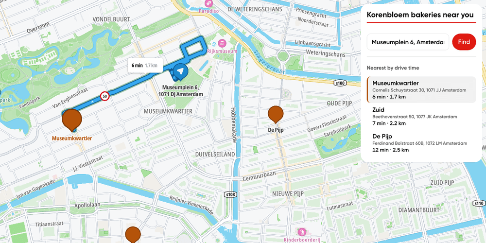
Store locator
Find the nearest of your own stores by drive time, from any address.
Getting Started
Bring Your Own Data
Places and POIs
Search and Geocoding
Routing
Web