
Map reachable ranges from multiple locations
Calculate time-based accessibility areas from multiple locations
Click anywhere and nested bands redraw around the new origin, showing how far you get on a budget of minutes or kilometres.
calculateReachableRangestakes every budget in one array, andReachableRangesModule.showdraws its answer unchanged. It titles each band from its budget and puts the smallest on top.- By default, the bands ramp from the map’s accent colour toward its land colour. Your own
fill.palettereplaces them in oneapplyConfig, and theinvertedfill style shades what lies out of reach instead. createLatestRequestdrops the call a fresh click supersedes, so the handler has no cancellation error to tell apart from a real failure.
Related examples
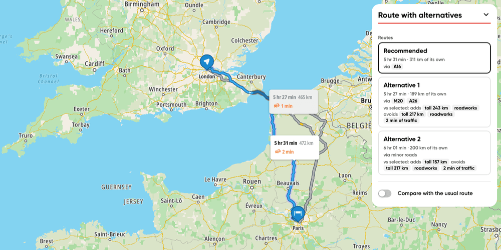
Route with alternatives
Display route alternatives and what sets each one apart
Getting Started
Routing
User Interaction Events
Utilities
Web

Add Stops to Route (Playground)
Dynamically add and remove intermediate stops on a route by clicking the map
Playground
Routing
Utilities
User Interaction Events
Web

Add Stops to Route
Find stops along a route within a one-minute detour and insert them all at optimal positions in a single call.
Getting Started
Routing
Search and Geocoding
Electric Vehicles
Utilities
Web

Along route search
Find the beaches and viewpoints within a one-minute detour of a coastal drive
Getting Started
Routing
Search and Geocoding
Web