AADT
Introduction
This guide covers the Annual Average Daily Traffic (AADT) data accessible via the Map Content Portal. Each release contains AADT volumes for road elements in the specified map version.
Release tags
In the Map Content Portal, each release is labeled with tags that describe its content:
- Type — one of two main tags:
aadt— the data files contain only theaadtvolume values.aaht— in addition to theaadtvalues, the data files also contain the average weekday traffic (d1-d7) and the average week hour traffic (d1h0-d7h23).
year— the year for which the traffic volumes are calculated.update— the version of the volumes for that year. The changes introduced in each update are described in its Release Notes.
Release Notes
After selecting a release, the Release Notes section at the top lists the changes introduced in that update. We recommend always using the latest update, as it contains the best available version of the AADT data.
Release files
Each region in the release contains the following files:
aadt_{mapVersion}_{countryCode}_{stateCode}_{year}_shp_aadt.zipa Shapefile archive containing the Annual Average Daily Traffic data for the region for the year.aadt_{mapVersion}_{countryCode}_{stateCode}_{year}_cvg_aadt.jsona JSON file with road network coverage information.
Data fields
For each road element, the following fields are provided:
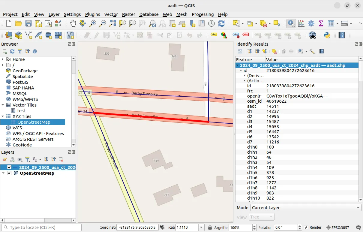
ida unique identifier for the road element.frcthe Functional Road Class of the road element indicates the importance of the road in the network. This is a value between0and9where0is considered most important and9least important. FRC 0 roads are highways and FRC 9 roads are back roads.openlra base 64 encoded OpenLR binary location reference for the road element. This is a map-agnostic way to identify the road element.osm_idthe OpenStreetMap Way ID of the road element. Where a road element spans multiple ways, a comma-separated list of Way IDs is provided.aadtthe average number of vehicles that traverse this road element in a day. This is calculated by dividing the total number of vehicles that traverse the road element in the year by the total number of days in the year.d1-d7the average weekday traffic on the road whered1is Monday andd7is Sunday. For example, for Monday, this is calculated by dividing the total number of vehicles that traverse the road element on Mondays during the year by the total number of Mondays in the year. Provided inaahtreleases only.d1h0-d7h23the average week hour traffic on the road whered1h0is the hour between midnight and 1am on Monday andd7h23is the hour between 11pm and midnight on Sunday. For example, for Monday between midnight and 1am, this is calculated by dividing the total number of vehicles that traverse the road element on Mondays between midnight and 1am during the year by the total number of Mondays in the year. Provided inaahtreleases only.
Coverage file
In addition to the Shapefile, a aadt_{mapVersion}_{countryCode}_{stateCode}_{year}_cvg_aadt.json file is provided with road network coverage information. The coverage information is provided per Functional Road Class. For each Functional Road Class, both the length of the road network covered by the data and the total length of the road network are provided. Both coveredLength and totalLength are expressed in meters.
{ "FRC0" : { "totalLength" : 3522516, "coveredLength" : 3446765 }, "FRC1" : { "totalLength" : 3382940, "coveredLength" : 3355337 }, "FRC2" : { "totalLength" : 8848407, "coveredLength" : 8821315 }, "FRC3" : { "totalLength" : 15286866, "coveredLength" : 15232944 }, "FRC4" : { "totalLength" : 28151126, "coveredLength" : 27735947 }, "FRC6" : { "totalLength" : 59894813, "coveredLength" : 27145800 }, "FRC7" : { "totalLength" : 117411909, "coveredLength" : 46201560 }, "FRC9" : { "totalLength" : 19673700, "coveredLength" : 211157 }}Loading the Shapefile
To open the Shapefile for viewing:
- Install a client that can read and display Shapefile format. We recommend QGIS or ArcGIS.
- Open QGIS.
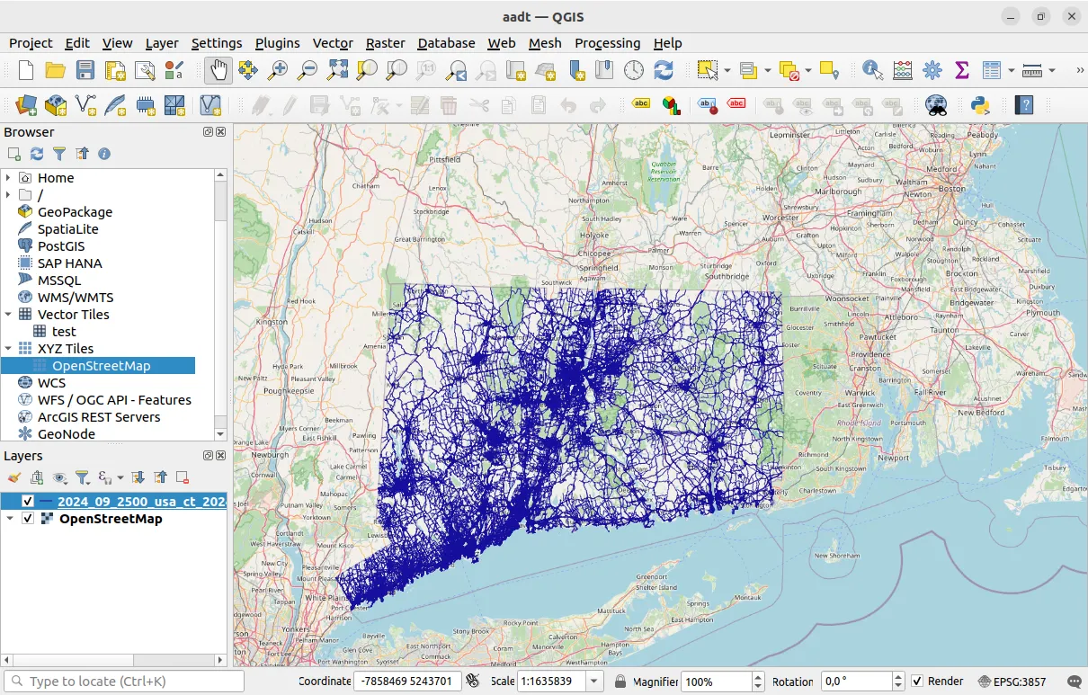
- Add a base map layer to the view, for example OpenStreetMap.
- Drag and drop the
aadt_{mapVersion}_{countryCode}_{stateCode}_{year}_shp_aadt.zipShapefile archive into the Layers panel in the bottom left of the UI. This will add the AADT layer to the view.
To view the AADT values for a single road element:
- Zoom into a road element on the map.
- In the top menu, select
View->Identify Features. - Right click on any road element. This will open the road element properties in the right panel.