
Premium Map Display
Release notes for map style templates used to create styles that target TomTom Maps & Navigation SDK for Android with the Premium Map Display renderer.
If your application uses Standard Map Display, see Standard Map Display.
If you don’t target TomTom Maps & Navigation SDK for Android, see Map Display API.
SDK 2.5
Style version 1.0.0-3
Released: 2026-07-17
Compatibility: TomTom Maps & Navigation SDK for Android 2.5.x. Premium Map Display requires SDK 2.5 or newer.
Update required: No. This is the first Premium Map Display style version.
New
- First release of the Premium Map Display style templates, with 3D landmarks, anti-occlusion, and environment, lighting and material properties.
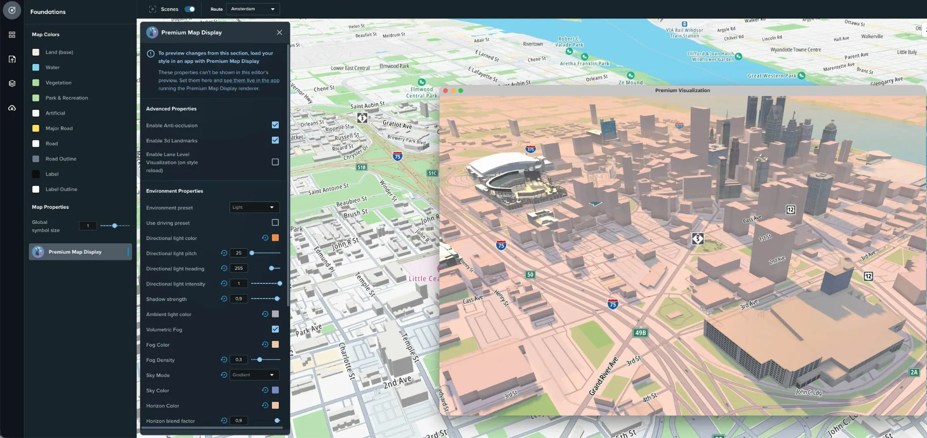
- 3D landmarks: textured 3D models of well-known buildings replace their plain building extrusions. They’re on by default and can be turned off in Foundations > Advanced Properties. In Buildings > 3D Landmarks material you can adjust texture saturation, brightness and contrast, and add a color gradient or bottom lighting.
- Anti-occlusion: navigation-critical features such as routes, traffic and roads stay visible when 3D buildings or landmarks are in front of them. It’s on by default and can be turned off in Foundations > Advanced Properties. You can customize its appearance in the relevant modules under Premium Map Display > Anti-Occlusion.
- Advanced properties: in Foundations, set the environment (directional and ambient light, shadow strength, fog, sky and horizon), the material preset, and an optional bloom effect. In Buildings > 3D Buildings material, set how metallic and smooth walls and roofs look, specular highlights, and a color gradient. These properties aren’t shown in the Map Maker preview, so check them in an app running Premium Map Display. For details, see Premium Map Display properties.
- Navigation & Routing module: customize how the route and guidance look in your app.
- Colors for the active route, its outline and progress, alternative and better routes, traffic on the route, safety locations and markers.
- Route width and traffic tube width, with optional scale-based widths, and the instruction arrows.
- Markers for waypoints, the route, traffic, hazards, safety locations, traffic lights and traffic signs, with their symbol size.
- A minimum zoom level for safety zones, and anti-occlusion materials for the route and traffic on the route.
- POI: Custom automotive brand controls in the POI module. Enter a primary and a secondary brand name, and POIs of those brands use your own icons from the style’s sprite and are shown before other POIs.
- Upload an icon for each category you want to brand. A matching POI whose icon is missing from the sprite is shown without an icon.
- Name each icon
poi-<category>-<brand name>when you upload it. Map Maker adds thecustom-prefix because there is no matching asset to replace. For example, with the brand nameTomTom, uploadpoi-vehicle_dealer-TomTom. It’s stored ascustom-poi-vehicle_dealer-TomTomand replacespoi-vehicle_dealerfor TomTom vehicle dealers. - A POI matches when its brand contains the name you entered, so
TomTomalso matchesTomTom Service Center. The match is case-sensitive.
- Map, traffic, hillshade and satellite tiles load from version 2 of the Orbis Map Display and Traffic APIs.